Fig. 4

Download original image
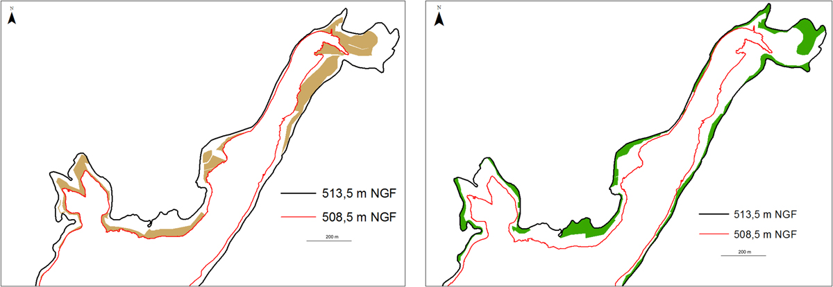
Map of the area occupied by silt (left) and by submerged vegetation (right), in the upstream part of the reservoir, between 513.5 (black) and 508.5 m NGF (red).
Cartographie de la surface occupée par la vase (à gauche) et par les ligneux émergents (à droite), dans la partie amont de la retenue, entre les cotes 513.5 (en noir) et 508.5 m NGF (en rouge).
Current usage metrics show cumulative count of Article Views (full-text article views including HTML views, PDF and ePub downloads, according to the available data) and Abstracts Views on Vision4Press platform.
Data correspond to usage on the plateform after 2015. The current usage metrics is available 48-96 hours after online publication and is updated daily on week days.
Initial download of the metrics may take a while.


